skip to main
|
skip to sidebar
Matthew's Maps
Monday, April 20, 2009
Digital Elevation Models (DEM)
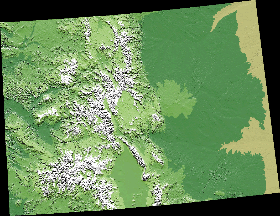
This is a Digital Elevation Model for Colorado. Colorado is known for its mountains so a digital elevation model is perfect for this state because it shows the elevation in a high definition way.
http://commons.wikimedia.org/wiki/File:Colorado.png
No comments:
Post a Comment
Newer Post
Older Post
Home
Subscribe to:
Post Comments (Atom)
Followers
Blog Archive
▼
2009
(50)
▼
April
(49)
Univariate Choropleth Map
Sonar Map
Mercator Projection
Continuously Variable Proportional Circle Map
bivariate choropleth map
Resource Map
Star Plot
Correlation Matrix
Similarity Matrix
Stem and Leaf Plot
Box Plot
Histogram
Parallel Coordinate Graph
Triangular Plot
Windrose
Climograph
Population Profile
Scatterplot
Index Value Plot
Bilateral Graph
Geopotential Heights Map
Isohyet Maps
Isotach Maps
Isobar maps
LIDAR
Doppler Radar Map
Black and White Aerial Photo
Cartographic Animations
Statistical Map
Cartograms
Flow Maps
Isoline Map
Proportional Circle maps
Dot Distribution Maps
Propaganda Maps
Hypsometric Maps
PLSS Maps
Cadastral maps
Thematic Map
Unclassed Choropleth Maps
Classed Choropleth Maps
Digital Raster Graphics
Digital Line Graphs (DLG)
Digital Orthographic Quarter-Quads (DOQQ)
Digital Elevation Models (DEM)
isopach maps
Topographic Maps
Planimetric Maps
Mental Maps
►
January
(1)
About Me
Matthew's Maps
View my complete profile
No comments:
Post a Comment